
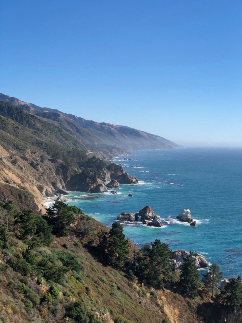
The stretch of California coast between Carmel and San Luis Obispo is one of the great road trips of the world, and it is also one of the best places we know to sleep outside. The mountains of Big Sur fall straight into the Pacific, the highway clings to the cliff between them, and the campgrounds sit in redwood canyons or on bluffs where you fall asleep to the surf. Further south, the coast softens into the dunes, tide pools and golden hills of Montana de Oro. Camping here takes planning, patience with the highway and a healthy respect for raccoons, but the reward is a week of mornings we still think about.
The Big Sur coast
Big Sur is not a town but a 90 mile (145 km) section of Highway 1 between Carmel and San Simeon, with the Santa Lucia Range rising to over 1,500 m (5,000 ft) within a few kilometres of the shore. The public campgrounds are strung along it. In the north, the state park campgrounds sit in the redwoods along the Big Sur River, sheltered and shady, a short drive from the coast. Andrew Molera State Park has a walk-in campground in a meadow about half a kilometre from the parking area, close to a wild beach at the river mouth. Julia Pfeiffer Burns State Park has just two environmental walk-in sites on a bluff above the famous waterfall cove, and they are among the hardest campsites in the state to book. Limekiln State Park offers a small campground in a redwood canyon with its own creek and old lime kilns to explore.
Book six months out
This is the part that catches people. The state park campgrounds on the Big Sur coast open their reservations roughly six months in advance, and the popular ones fill within minutes of the window opening, especially for weekends between spring break and October. The national forest campgrounds work on a similar calendar. If you want a summer weekend, set a reminder for the exact day and hour six months earlier and be ready to book. Midweek nights in the shoulder seasons are much easier, and cancellations do appear if you check regularly in the weeks before your trip. If everything is full, there are backcountry campsites in the Ventana Wilderness reachable on foot, and the coastal canyons a few kilometres inland are often empty when the highway campgrounds are packed.
Kirk Creek and the southern bluffs
Our favourite camp on the whole coast is Kirk Creek, a national forest campground on a grassy bluff about 30 m (100 ft) above the ocean in the southern half of Big Sur. Every site has a view of the water, and a handful of walk-in tent sites sit right on the edge of the bluff, a short carry from the parking loop, with nothing between you and the Pacific. There is no potable water at Kirk Creek, so bring all you need. A trail across the highway climbs steeply into the mountains and gives a fine half-day walk with the whole coast laid out below. A few kilometres south, Plaskett Creek is a larger, greener campground in a grove of pines and cypress across the road from a beautiful cove with a natural stone arch. Both are quieter than the northern redwood parks and feel far more remote.
Highway 1 closures
The Big Sur highway is one of the most landslide-prone roads in the country. Winter storms bring down slopes that close the road for weeks or months, and in some years a section in the south has been closed for the better part of a year while crews rebuild it. This changes everything about a trip. A campground that is 30 minutes from the north may be reachable only from the south, or not at all. Always check the state highway conditions the day before you leave and again the morning of, and have a plan for a long inland detour. Fuel is limited and expensive along the coast, so fill up in Carmel or Cambria.
Montana de Oro
About 160 km (100 miles) south of Big Sur, past the elephant seals at San Simeon and the fishing town of Morro Bay, Montana de Oro State Park protects roughly 32 square kilometres (8,000 acres) of coastal bluffs, dunes, canyons and hills near the small town of Los Osos. The Islay Creek campground has around 50 primitive sites in a creek valley a few hundred metres from the beach at Spooner’s Cove, with vault toilets and no showers. The Bluff Trail runs for several kilometres along sandstone cliffs above tide pools and small coves, and is one of the finest easy coastal walks in California. For a bigger day, the trail to Valencia Peak climbs to 411 m (1,347 ft) and looks down the whole coastline. The park name means mountain of gold, for the wildflowers that cover the hills in spring, and April is a spectacular month to visit.
Fog, fire and raccoons
Three practical things shape a trip here. The first is fog. From May through August the marine layer rolls in most afternoons and often does not lift until midday, especially near the water. The clearest, warmest weather on the coast comes in September and October, which is our preferred season. Winter brings rain and the landslides that follow.
The second is fire. The Santa Lucia Range burns regularly, and campfire restrictions are the norm from summer through the first rains. In the national forest campgrounds, fires and even stoves may be limited during high fire danger, and a fire permit is required for any stove outside a developed site. The state parks allow fires in the provided rings only when conditions permit. Check the current rules on arrival and never assume last year’s rules apply.
The third is raccoons. The campgrounds along the Big Sur River are home to some of the boldest raccoons we have ever met. They open coolers, unzip tents and work in teams. Store every scrap of food, toiletries and rubbish in a locked vehicle or the metal locker provided, and do it before dusk. Ravens and jays patrol the picnic tables by day. Add to that poison oak along most trail edges and ticks in the grass, and you have the full Central Coast experience. It is still worth every minute.