
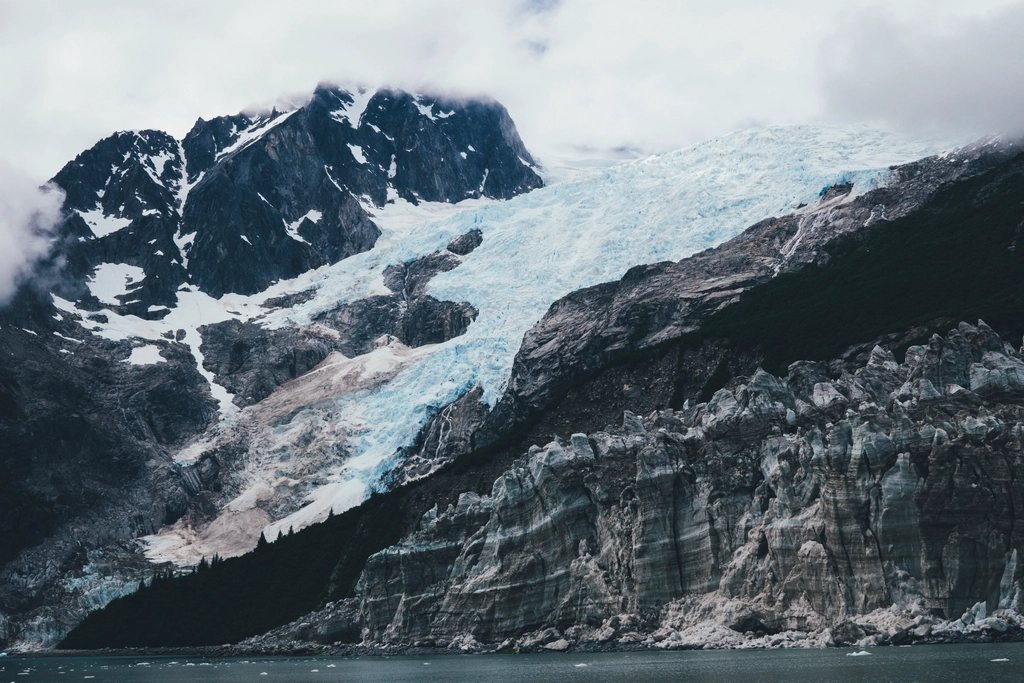
Alaska is big enough that it can be hard to know where to begin. Most of the state has no trails at all, and much of the rest needs a bush plane or a boat to reach. But two hikes on the road system between Anchorage and the interior give an honest taste of what makes the place extraordinary, and both can be done without a guide, a permit lottery or a helicopter. The Harding Icefield Trail near Seward climbs from a rainforest valley to the edge of a sea of ice. Kesugi Ridge in Denali State Park is a multi-day walk along an open alpine crest with the highest mountain in North America filling the western sky. We have done both more than once, and we would go back tomorrow.
The Harding Icefield Trail
The trail begins at the Exit Glacier area of Kenai Fjords National Park, about 12 miles (19 km) by road from the town of Seward on the Kenai Peninsula. It is 8.2 miles (13.2 km) round trip and it gains roughly 1,000 ft of elevation for every mile walked, for a total of close to 3,500 ft (about 1,050 m). That ratio tells you everything: it is steep from the first switchback to the last. Most fit hikers take six to eight hours for the round trip, and there is no shame in taking longer.
The trail climbs in distinct stages. It starts in dense cottonwood and alder forest beside the glacier, then breaks out at Marmot Meadows around 1.4 miles (2.3 km), where the first big views of Exit Glacier open up. From there it works up to a rocky bench called Top of the Cliffs at about 2.4 miles (3.9 km), and then onto open rock and snow above the treeline. The final stretch reaches an emergency shelter and a viewpoint over the Harding Icefield itself: a white plain of ice roughly 700 square miles (1,800 sq km) in extent, with only the tips of buried mountains, called nunataks, breaking the surface. It is the largest icefield entirely within the United States, and it feeds around 40 glaciers, including the one you have just walked beside.
Snow lingers on the upper half of the trail well into July, and in early season the route above the cliffs is a snow slope rather than a path. Cloud can close in quickly, and the top is often colder and windier than the trailhead by a wide margin. The trail is free to hike; the park charges no entrance fee at Exit Glacier. The access road is normally open to vehicles from May until the snow comes in November.
Kesugi Ridge in Denali State Park
Denali State Park is the smaller neighbour of the national park, straddling the highway about 130 miles (210 km) north of Anchorage, and Kesugi Ridge is its showpiece. The full traverse runs about 27 miles (43 km) between the Little Coal Creek trailhead in the north and Byers Lake in the south, with a middle exit at Ermine Hill that lets you shorten the trip to roughly 17 miles (27 km). The ridge sits mostly between 3,000 and 4,000 ft (900 to 1,200 m), which in this part of Alaska is well above the trees. From the crest the ground drops to the wide braided channels of the Chulitna River and then rises, in one enormous step, to the Alaska Range. On a clear day Denali, at 20,310 ft (6,190 m), stands directly across the valley.
The northern access from Little Coal Creek is the steepest, climbing about 2,000 ft (600 m) in the first 3 miles (5 km) to reach the ridge. Once up, the route wanders over tundra, rock and small tarns, marked by cairns rather than a worn path in many places. In fog, which is common, the cairns are the only thing between you and a long detour. Most people take two to four days, camping beside the tarns. There is no permit for backpacking in the state park, though there is a parking fee at the trailheads, and camping on the ridge is unrestricted as long as you stay off the vegetation where you can and carry everything out.
Bears on both trails
Black bears are common around Exit Glacier, and both black and brown bears use Kesugi Ridge and the valleys below it. This is not a reason to stay home; it is a reason to behave well. Make noise in brushy sections, walk in a group where you can, and never approach or feed wildlife. Carry bear spray where you can reach it, not inside your pack. On Kesugi, store food in a bear-resistant canister and cook and eat well away from where you sleep. Tents should go on open ground with a clear view around them.
Weather and season
The realistic season for both hikes runs from June to September. Snow blocks the upper Harding Icefield Trail until mid-summer, and Kesugi Ridge can hold snow patches into late June. July is warm by Alaskan standards, with long daylight and plenty of mosquitoes in the lowlands. August brings more rain and the start of the blueberry crop on the ridge. September is our favourite month on Kesugi: the tundra turns red and gold, the bugs are gone, the air is clear, and the first snow can fall at any moment. Rain gear that actually works, warm layers, a hat and gloves are essential on both hikes at any time of summer.
What to pack
- Full rain shell and pants, since coastal Seward averages well over 1,500 mm (60 in) of precipitation a year
- Insulating layers for wind and cold on the ridges and at the icefield edge
- Bear spray, a bear canister for overnight trips, and a map and compass for the cairned sections
- Water treatment; streams and tarns are plentiful on Kesugi but not always clean
- Traction aids in early season for the snow slopes above Top of the Cliffs
Putting it together
The two hikes sit about a full day’s drive apart, with Anchorage in between, and combining them makes a satisfying week. Do Harding as a long day from Seward, rest, and then head north for three days on Kesugi. Neither requires technical skill, but both demand respect for weather that changes by the hour and for country where help is far away. Go prepared, go slowly, and keep looking up.