
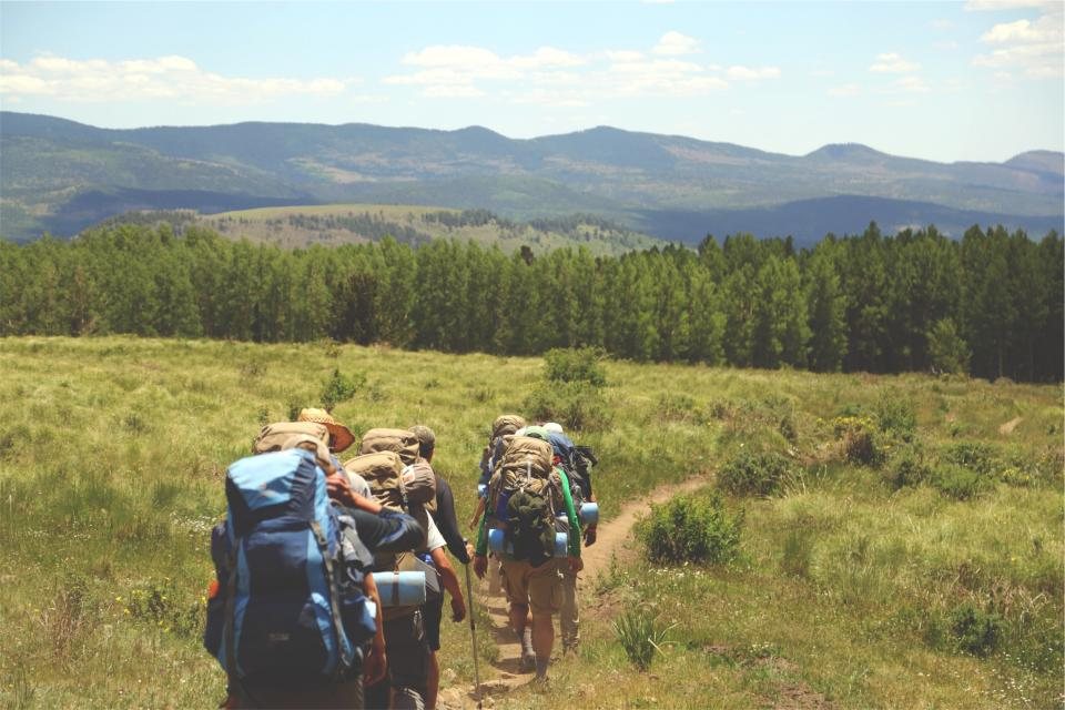
The Superior Hiking Trail follows the rocky spine of Minnesota’s North Shore for roughly 300 miles (about 480 km), from the outskirts of Duluth to the Canadian border. It never strays far from Lake Superior, the largest freshwater lake in the world by surface area, and yet it spends most of its time up on the ridges, in maple and birch forest, looking down on the water. We have hiked it in pieces over several seasons, and it has become one of the trails we recommend most often to people who want a real backpacking trip without the permit lotteries and altitude of the western mountains.
The shape of the trail
The route begins near the Wisconsin state line and runs about 40 miles (64 km) through the city of Duluth on parkland and creek corridors before it reaches the open shore. From there it climbs into the Sawtooth Mountains, a line of ancient volcanic ridges that parallel the lake all the way to the border. The trail crosses a string of state parks along the way, including Gooseberry Falls, Split Rock Lighthouse, Tettegouche, Temperance River, Cascade River and Judge C. R. Magney, before it ends at a viewpoint above the Pigeon River, which forms the boundary with Ontario.
The lake sits at about 600 ft (183 m) above sea level and the high points of the trail reach around 1,800 ft (550 m), so the numbers look tame. Do not be fooled. The trail rarely stays level. It drops into every river gorge and climbs back out onto the next ridge, and a typical day involves several hundred metres of cumulative gain over rocks, roots and mud. The footing is honest North Woods terrain. The trail is marked with blue blazes and is well signed at road crossings and junctions.
Free campsites, first come first served
This is the part that makes the trail special. There are more than 90 designated backcountry campsites along the route, spaced roughly every 5 to 8 miles (8 to 13 km). Each has a latrine, a fire ring and cleared tent pads, most sit beside a stream or lake, and every one of them is free. There are no permits, no fees and no reservations. Sites are first come, first served, and the etiquette is to share: if you arrive late and the pads are taken, you squeeze in, and if you arrived early, you make room. Camping is only allowed at these designated sites, not at random spots in the forest.
The exception is the state parks, where the trail passes through drive-in campgrounds that do require reservations and fees. Many hikers use them as resupply and shower stops. Water is generally abundant along the trail, but some of the ridge sections between rivers are dry for several miles, and every source should be filtered or treated.
Ridge views and river gorges
The best moments on the trail come when the forest opens onto a bare rock outcrop and the whole sweep of Lake Superior appears below, often with the far shore invisible and the water the same grey-blue as the sky. Some of the classic viewpoints include the loop around Bean and Bear Lakes near Silver Bay, the summit of Carlton Peak at about 1,526 ft (465 m), the Oberg Mountain loop near Lutsen, and Pincushion Mountain above Grand Marais. Between them, the river gorges are just as memorable: the Split Rock River with its red rock walls, the Baptism River with its high falls, and the Cascade River tumbling down a staircase of dark basalt.
Section hiking the North Shore
A thru-hike takes most people two to four weeks, but the trail was built for sections. Trailheads with parking appear every 5 to 12 miles (8 to 19 km), so almost any distance can be turned into a day hike or an overnight. A few of our favourite sections for a two or three day trip:
- Split Rock River loop and the ridge north toward Beaver Bay, about 12 miles (19 km), with cliffs and lake views
- Silver Bay to Tettegouche State Park by way of Bean and Bear Lakes, about 15 miles (24 km)
- Temperance River to Lutsen over Carlton Peak and Oberg Mountain, about 20 miles (32 km), best in colour season
- Grand Marais to Judge C. R. Magney State Park, about 25 miles (40 km), quieter and wilder
Shuttle services run along the shore in season, and the shore highway has bus connections between towns, which makes a one-way section walk easy to arrange. Many hikers park at the end trailhead and take a shuttle to the start.
Seasons: black flies, colours and snow
The trail is usually hikeable from mid-May to late October. Spring is muddy and the rivers run high, but the waterfalls are at their best. June is beautiful and also the peak of black fly and mosquito season; a head net weighs almost nothing and we would not go without one from late May through early July. July and August are warm, sometimes humid, with fewer bugs and more thunderstorms. Then comes the reason many people plan their trip around the calendar: the maples along the ridges turn scarlet and orange in the last two weeks of September, with the birches and aspens following in gold into early October. The colour show is genuinely spectacular, and the crowds at the state park trailheads reflect that. Winter comes early. Snow can arrive in October and the trail is not maintained for winter travel, though snowshoers use some sections.
What to know before you go
Bring proper rain gear, because weather comes off the lake fast and the temperature can drop 10 C (18 F) in an hour when the wind turns onshore. Black bears live along the whole route; hang your food or use a bear canister, and cook away from your tent. Ticks are present from spring through fall, so check yourself each evening. The trail is maintained by a volunteer association that publishes a detailed guidebook and maps, and buying them supports the work that keeps the campsites free. Cell coverage is patchy on the ridges and absent in the gorges. Tell someone your plan, carry a paper map, and expect the trail to take longer than the distance suggests. Then slow down, sit on a rock above the lake, and let the North Shore do what it does best.