
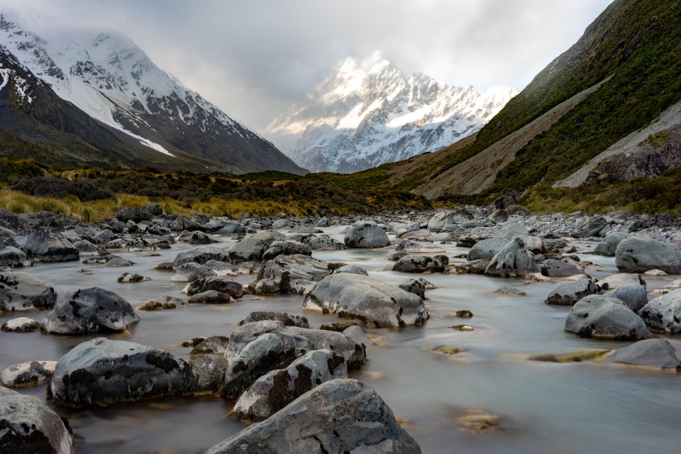
The John Muir Trail is the finest three weeks of walking in the United States, and we do not say that lightly. It runs 211 miles, or about 340 kilometres, from Happy Isles in Yosemite Valley to the summit of Mount Whitney, the highest point in the contiguous United States at 14,505 feet. Along the way it crosses the High Sierra by a chain of granite passes, blue lakes and lodgepole forests without touching a paved road. The walking is not technical. The hard parts are the permit, the resupply and the altitude, and this guide is about those three things.
The permit puzzle
Most people walk southbound, starting in Yosemite and finishing on Whitney, because it gains altitude gradually and ends on a high. A southbound permit is issued by Yosemite, and the constraint is the Donohue Pass exit quota: only a limited number of walkers per day, around 45, may leave the park over Donohue Pass on a wilderness permit. Requests go into a rolling lottery that opens 24 weeks before the intended start date, and the trailheads that lead to Donohue, principally Happy Isles, Glacier Point and Lyell Canyon, are heavily oversubscribed. Applying for a range of start dates and several trailheads improves the odds enormously.
Northbound walkers start from Whitney Portal, which means entering the Whitney zone, and those permits go through a separate lottery run by the national forest early in the year. A third approach is to start outside Yosemite, for example from Tuolumne Meadows towards the south or from a trailhead over Kearsarge Pass, and skip Donohue altogether. Whichever route you take, one permit covers the whole trail, and Whitney is included as long as the permit shows an exit at Whitney Portal.
The passes
The trail is a sequence of climbs to passes and descents into canyons. Southbound, the first big one is Donohue Pass at 11,056 feet, the border of Yosemite. Then come Island Pass, Silver Pass at 10,895 feet, Selden Pass at about 10,900 feet, and Muir Pass at 11,955 feet, where a stone hut sits in a moonscape of rock and tarns. After the Palisades comes Mather Pass at 12,100 feet, Pinchot Pass at 12,130 feet, Glen Pass at 11,978 feet, and finally Forester Pass at 13,153 feet, the highest point on the whole Pacific Crest Trail and the gateway to the Whitney region. From Forester the trail runs to Guitar Lake and then up the west side of Whitney to the summit, before descending 11 miles and about 6,000 feet to Whitney Portal.
The total ascent over the trail, including the Whitney summit and the descent to the portal, is around 47,000 feet, about 14,000 metres. Spread over three weeks that is manageable, but it is a serious number and the passes come thick and fast in the southern half.
Bear canisters and resupply
Approved bear-resistant canisters are required along the entire trail, and rangers check. A canister holds about seven days of food for a careful packer, which shapes the resupply plan more than anything else. The trail passes close to several resupply points in its northern half: Tuolumne Meadows a few days in, Reds Meadow near Devils Postpile, Vermilion Valley across Lake Edison, and Muir Trail Ranch just before the halfway point. Each accepts mailed buckets or offers a small store, and details change from year to year, so we confirm every one before shipping.
South of Muir Trail Ranch the trail enters its longest wild stretch, over 100 miles with no easy resupply. The usual solution is a side trip over Kearsarge Pass to Onion Valley and the town of Independence, a detour of a day or more, or a hired packer who brings food to the trail. Some walkers carry eight or nine days from the ranch and go straight through. We have done both; the detour costs time but the lighter pack over Mather and Pinchot is a joy.
Altitude, weather and August
Almost the whole trail lies above 8,000 feet and the southern half rarely drops below 10,000. Altitude sickness is the most common reason people leave early. Southbound walkers have a built-in advantage because the first week climbs gently, but a night or two at Tuolumne Meadows before starting helps, and anyone flying in from sea level should build in a slow first three days. Headaches, poor sleep and a lost appetite are normal at first; worsening symptoms mean going down.
The season runs from July to September. In a normal snow year, July still has snow on Forester and Muir, high creeks and mosquitoes; September brings cold nights and the risk of early storms. August is the sweet spot: passes clear, creeks tame, bugs mostly gone, and long dry days. Afternoon thunderstorms are common and Whitney’s summit is no place to be when they build, so summit days start well before dawn. Fires are banned above 10,000 feet and often below it in dry years, so a stove is the only way to cook.
Water, camps and daily rhythm
Water is abundant in the Sierra, with lakes and creeks at intervals of a few miles, and we treat all of it. Camping is at large, with the usual rules: 100 feet from water, on durable ground, no camping at a few heavily used lakes where signs say so. That freedom lets you choose your own daily distance. We favour a rhythm of climbing a pass in the morning, lunch at the top, and camping by a lake a few miles down the far side, which keeps the tent below the worst of the cold and the wind.
What we would tell a friend
Apply for the permit early and flexibly, then build the resupply plan around the bear canister rather than the other way round. Give yourself twenty days or more; the trail is too good to rush. Treat altitude with respect. And carry a real map, because the trail is well marked but the junctions near Whitney are where tired minds make mistakes.
- Distance: 211 miles / 340 km, Yosemite Valley to Mount Whitney, plus 11 miles down to Whitney Portal
- Highest pass: Forester at 13,153 ft; trail high point Mount Whitney at 14,505 ft
- Permit: Yosemite lottery with the Donohue Pass quota for southbound walkers
- Bear canister: required for the entire route
- Season: July to September, best in August
Three weeks of granite and sky, one canister of food at a time. Few journeys have changed the way we walk as much as this one.