
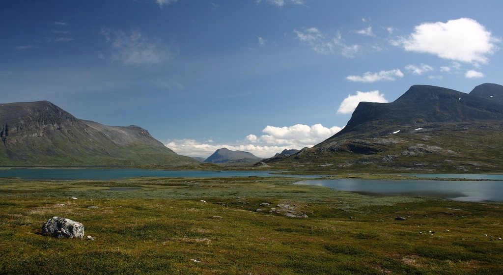
The Kungsleden, the King’s Trail, runs for about 440 kilometres through the mountains of Swedish Lapland, and the northern section from Abisko to Nikkaluokta is the part that most walkers know. It is roughly 105 kilometres, takes five to seven days, and lies entirely above the Arctic Circle in a landscape of broad birch valleys, glacial lakes and treeless passes. We have walked it in high summer under a sun that never set and in September when the birches had turned gold and the first snow dusted the tops. This guide sets out the stages, the hut system, the Kebnekaise detour and the timing that makes the difference between a memorable week and a miserable one.
Stages and huts
The trail begins at Abisko, a small settlement on the railway line between Kiruna and Narvik, and follows the Abisko river valley into the national park. The first stage of 15 kilometres ends at Abiskojaure, a hut beside a lake in the birch forest. The second, 22 kilometres, climbs out of the trees to Alesjaure, a cluster of huts on a rise above a long lake, with a boat service on the lake that shortens the stage for those who want it. The third stage of 13 kilometres crosses the treeless plateau to the small hut at Tjaktja, and the fourth climbs to the Tjaktja Pass at 1,140 metres, the high point of the whole Kungsleden, before dropping into the Tjaktjavagge valley to Salka, about 12 kilometres. The fifth stage runs 12 kilometres down the valley to Singi, where the main trail continues south and the route to Nikkaluokta turns east.
From Singi it is 14 kilometres to the Kebnekaise mountain station and a final 19 kilometres, with an optional boat across the lake at Ladtjojaure, to the road end at Nikkaluokta and the bus to Kiruna. The huts are run by the national touring association and spaced a comfortable day apart. They have bunks, wood stoves, gas cookers and a warden, but no electricity or running water; you fetch water from the stream and carry firewood in. Several have a sauna, which is the finest reward for a wet day we know. Small shops at some huts sell basic food, so a walker can carry three or four days and top up along the way.
The Kebnekaise detour
Kebnekaise is the highest mountain in Sweden, and its summit height is a moving target because the south top is a glacier that has been melting for decades; it now sits just under 2,100 metres, and the rocky north top has become the true high point. The mountain station sits at the foot of the mountain on the way to Nikkaluokta, and most walkers plan a rest day there for the ascent. The western route to the summit is a long, non-technical but strenuous day of around 1,800 metres of ascent with some easy scrambling, and guided groups go up most days in summer. The eastern route crosses a glacier and needs a guide and equipment. We have done the western route in cloud and wished we had waited a day; the view on a clear morning reaches across a tenth of Sweden.
Sami land
The whole route passes through the traditional lands of the Sami, and reindeer herding continues here as it has for centuries. Fences, corrals and small cabins along the trail belong to working herders, and reindeer wander through the camps in summer. Walkers are guests. We keep distance from the herds, never approach calves, close gates, and leave the cabins alone. The Sami names on the map, from Tjaktja to Kebnekaise itself, are the original names of this landscape, and it is worth learning what they mean.
Camping and the right to roam
Sweden’s right of public access allows wild camping almost anywhere, and many walkers on the Kungsleden combine hut nights with tent nights. The exception is Abisko National Park, where camping is restricted to designated spots near the huts. Beyond the park boundary a tent may go up on any suitable ground away from the huts, and there are wonderful pitches by the lakes above Alesjaure and in the Tjaktjavagge. Campers can still use the hut kitchens and saunas for a fee, which makes the mixed approach very attractive. The trail is well marked with red crosses on poles, and the boggy sections are bridged with duckboards for kilometres at a time.
Mosquitoes and timing
The huts open in late June and close in late September, and within that window the timing matters more than on almost any other trail we know. July is the mosquito season. In warm, still weather the birch valleys hum with them, and a walker without a head net and repellent will not enjoy Abiskojaure. The plateau above the trees is better because of the wind, but the evenings near water are hard. By mid-August the mosquitoes fade, and from the last week of August through the middle of September the trail is at its best: the air is cool and clear, the birch turns gold and the blueberry leaves red, the first snow dusts Kebnekaise, and the huts are quiet. Nights are dark enough for the northern lights by September, and cold enough for frost, so a proper sleeping bag is needed.
Rain and wind can arrive on any day. The Tjaktja Pass is exposed and has a small shelter at the top; we cross it early and do not linger in poor weather. Water is everywhere and the streams are clean enough that most walkers drink without treating; we take the small fast side streams rather than the lake outflows.
How we would plan it
Take the night train to Abisko and walk south, so the boat options and the Kebnekaise detour fall naturally at the end. Allow seven days including the summit attempt. Go in the last week of August or the first of September. Carry a tent even if you plan to use the huts, because the freedom to stop early by a lake is half the pleasure of Lapland.
- Distance: about 105 km, Abisko to Nikkaluokta, plus the Kebnekaise ascent
- Days: 5 to 7, with huts a day apart
- High point: Tjaktja Pass at 1,140 m on the trail, Kebnekaise close to 2,100 m as a detour
- Season: late June to late September, best from late August
- Camping: right of public access, except in Abisko National Park
The King’s Trail is gentle underfoot and vast to the eye. Walk it when the mosquitoes have gone and the birches have turned, and you will understand why the Swedes made it a national institution.